2010-12-19
distance = 53
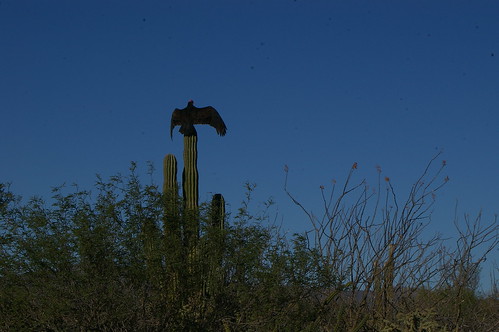
We dined with Ian and Mo one last evening, endured Mexican party music blasting from the South end of the campground at 4am, and set out for to La Paz by 8am the next morning. This time we were riding up the steep side of the hill about an hour and a half of strict climbing. Rob stopped to take a photo of the turkey vultures doing what he called "their morning yoga". Something like the warrior position their wings extended to either side while perched atop a cardon cacti fingers up to the sky.
Our final destination would eventually be Todos Santos on the Pacific Coast of the peninsula. We were advised to go straight from La Ventana through some smaller communities, but it would have made for an over 100km day in the hot hot sun. We arrived in La Paz in time for lunch, a visit to the Ferreteria (hardware store) where the woman attendant helped fixed my front basket carrier. Rob did some grocery shopping in what felt like a Walmart disguised as a latino supermercado (supermarket) and we ate a rich milk chocolate and almond covered icecream bar not available in most tiendas.
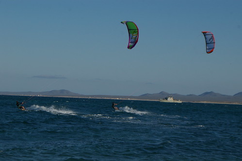
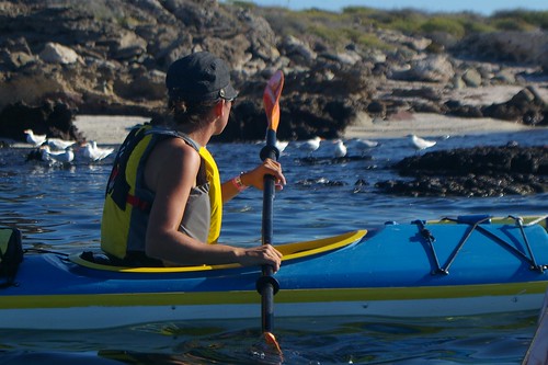
We had also come back to La Paz to consider doing another kayak trip but decided against it. We've entered the phase of our voyage where the end of the trip is nigh, as well as the outer limits of our budget. An enthusiasm for kayaking (and maybe kiteboarding?!) is one souvenir I'll be taking home with me to be taken up with gusto in waters closer to home. We booked into a hotel on the outskirts of town and staged for our last desert ride out to the small town and gringo haven of Todos Santos.

distance = 53
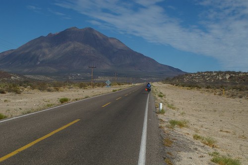
We dined with Ian and Mo one last evening, endured Mexican party music blasting from the South end of the campground at 4am, and set out for to La Paz by 8am the next morning. This time we were riding up the steep side of the hill about an hour and a half of strict climbing. Rob stopped to take a photo of the turkey vultures doing what he called "their morning yoga". Something like the warrior position their wings extended to either side while perched atop a cardon cacti fingers up to the sky.
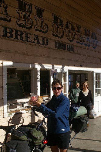
Our final destination would eventually be Todos Santos on the Pacific Coast of the peninsula. We were advised to go straight from La Ventana through some smaller communities, but it would have made for an over 100km day in the hot hot sun. We arrived in La Paz in time for lunch, a visit to the Ferreteria (hardware store) where the woman attendant helped fixed my front basket carrier. Rob did some grocery shopping in what felt like a Walmart disguised as a latino supermercado (supermarket) and we ate a rich milk chocolate and almond covered icecream bar not available in most tiendas.
We had also come back to La Paz to consider doing another kayak trip but decided against it. We've entered the phase of our voyage where the end of the trip is nigh, as well as the outer limits of our budget. An enthusiasm for kayaking (and maybe kiteboarding?!) is one souvenir I'll be taking home with me to be taken up with gusto in waters closer to home. We booked into a hotel on the outskirts of town and staged for our last desert ride out to the small town and gringo haven of Todos Santos.


